Photography by Kevin Revolinski
If you like to canoe or kayak, Wisconsin’s evenly distributed abundance of lakes and runnable rivers and streams means you are never far from a put-in. Northern Wisconsin is especially attractive, with national forests and riverways, vast acreage of protected lands and waters, and a real sense of remoteness. While a person could write a whole book on the possibilities, there are five exceptional destinations you shouldn’t miss.
PADDLERS’ PARADISE
BOIS BRULE
The River of Presidents, this Class 1 trout stream has hosted five American heads of state. Spring-fed, the clear waters start modest and finish with rapids as the river flows 44 miles north to Lake Superior through the Brule River State Forest. The section from Stones Bridge to Winneboujou is easy going, but advanced paddlers prefer the more challenging rapids five miles north of US Highway 2.
APOSTLE ISLANDS SEA CAVES
Twenty-one islands off the Bayfield Peninsula along with 12 miles of mainland shoreline make up the Apostle Islands National Lakeshore. Paddling here is more appropriate for sea kayaks, and a trip out across the open water to see the sea caves on Sand Island is something you’ll never forget. But a trip to the sandstone cliffs back on shore is the most popular and accessible. Putting in at Meyers Beach, paddlers head east a mile to where beautiful sandstone cliffs, carved by wind, waves, and winter ice, rise out of the water. You can paddle into crevices, caves, and snug tunnels. Lake Superior is always to be taken seriously – it’s taken down ore ships at its worst – but with the proper safety information and preparation, paddlers of all levels can enjoy it. Local outfitters run guided trips, leaving planning and instruction to experts.
WISCONSIN RIVER
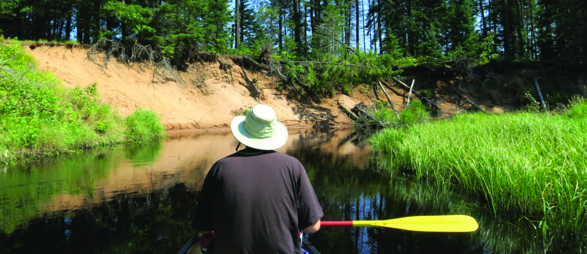
The state’s hardest working river with its 25 hydroelectric dams, the Wisconsin River is perhaps best known for the carved sandstone of the Wisconsin Dells as well as its wide, sandbar-filled final stretch before it meets the Mississippi. But the humble headwaters which arise from spring-fed Lac Vieux Desert near the border with Upper Peninsula Michigan offers a narrow, meandering delight through pine forest and around bends with high sandy banks. Tea-colored waters riffle over a sandy bottom providing easy paddling and abundant wildlife viewing. Overnight paddlers can make use of various rustic campsites along the banks.
CROIX NATIONAL SCENIC WATERWAY
The St. Croix is a phenomenal river, rising up as a creek that famously offered a historic portage to the Bois Brule. A short distance south of there, it enters Upper St. Croix Lake from where the creek officially becomes a river and goes on to form the border between Wisconsin and Minnesota before merging with the Mississippi. A total of 255 miles of the riverway, which includes the 101-mile tributary, the Namekagon River, are protected as a national park. The southernmost reaches flow wide and slow between towering bluffs and rock outcrops, while the middle section, especially the Marshlands, has a bit of whitewater and seclusion where you might spot a bear and definitely will see eagles or osprey. The upper stretches, especially the Namekagon, offer a narrower and more intimate float, often riffling through tighter turns. These northerly stretches are best early in the season when water levels are more reliable. Much like the upper Wisconsin, the St. Croix and Namekagon Rivers offer rustic campsites for longer trips.
TURTLE-FLAMBEAU FLOWAGE
A dam backed up the waters of the Turtle and Flambeau Rivers to create this 19,000-acre lake with abundant islands and miles of shoreline. While much of it is also shared with anglers, a quiet zone is maintained where you are not likely to hear motors. With several boat landings to choose from, paddlers can see a different part of the flowage each trip, and unlike the river journeys, you don’t need a shuttle back to your vehicle. Turn it into an overnight excursion by taking advantage of the 66 free first-come, first-served rustic campsites scattered throughout the territory. For a bonus, the North Fork Flambeau River offers river runs below the dam.
This article originally appeared in the 2016 spring/summer issue of Experience Wisconsin magazine. The contents of this article were checked for accuracy when it was published; however, it’s possible some of the information has changed. We recommend you call first if you have specific questions for the destinations, attractions or restaurants mentioned in this article.
No portion of this article or magazine may be reproduced without prior written permission by the publisher.


1 Comment
Pingback: Exploring Native Wisconsin | Experience Wisconsin