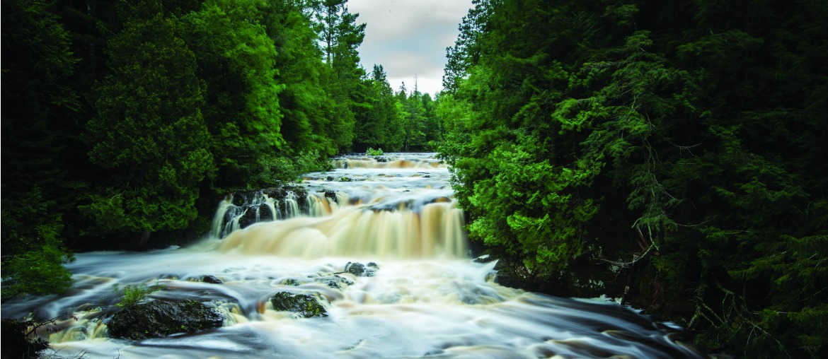
Photography courtesy of Travel Wisconsin
Waterfalls seem a lot like unexpected windfalls in Wisconsin because the average traveler doesn’t come here with the expectation of seeing water careen over cliffs and rocky outcroppings.
We are no Niagara Falls, but in the Badger State you’ll find at least 70 waterfalls, and the Department of Natural Resources pinpoints northern Wisconsin as home to the majority.
Some are a challenge to see because a remote walk is involved, but to reach a waterfall during an autumn hike or an outing on snowshoes is a beautiful reward for the physical effort.
Waterfalls in Wisconsin are more likely to flow agreeably and splash, not cascade and crash because of modest elevations. Steepness of descent is one difference between a waterfall and rapids. Another is where and how the water plummets.
The transformation from trickle to waterfall, through erosion of soft rock, takes thousands of years. The ecosystems that surround waterfalls are both fragile and robust, unless droughts or humans interfere.
Counties that touch moody Lake Superior are most likely to contain waterfalls because of dramatic geological formations within the lake superior watershed. none of the other Great Lakes shorelines contains more waterfalls.
Wisconsin’s tallest, Big Manitou Falls, splashes 165 feet into the Black River and is a part of Pattison State Park, near the lake and community of Superior. The Misty Chute is about as tall as Niagara falls but narrower, and it is the fourth largest waterfalls east of the Rocky Mountains.
View the natural splendor from hiking trails near a Highway 35 pedestrian tunnel, or follow a steep, half-mile park trail downhill to the river for vista views of the falls and gorge. Also in the 1,436-acre park is Little Manitou Falls, which is 31 feet high. Neither likely would exist if plans for a power dam would have proceeded in 1917; iron ore mine operator Martin Pattison found out about the project and bought 660 riverfront acres to thwart it.
In Iron County, Potato River Falls, Saxon Falls and Superior Falls all are 90 feet high. Less than 20 miles separate them. Look for easy access to the Potato River near Gurney on Highway 169; trails and stairs lead to viewing platforms in Potato River Falls Park. Intrepid hikers may prefer a view from the rugged upper-falls trail.
The best perspective of Superior Falls, near the Wisconsin-Michigan border and Lake Superior, comes from following Highway 122 one-half mile into Michigan, then taking a marked gravel road left. Less than five miles downstream is Saxon Falls, but it is harder to get a good look at because of its more remote location on the Montreal River.
Little Wren Falls, five miles northwest of Upson in Iron County, is only 15 feet high but among the most scenic in Wisconsin because of the way this waterfall leads to a deep gorge and Tyler Forks River. It is a challenge to find, and the trek involves a dirt road, unmarked roads and a fork in the road. Ask the locals for directions.
Inside Chequamegon-Nicolet National Forest, near Mellen, a hiking trail (accessible for people with disabilities) leads to tall and slender Morgan Falls. The 70-foot-tall water chute zigzags into an Ashland County creek. Take a good look, and then ascend one steep and rugged mile to the granite St. Peter’s Dome, which is the forest’s highest point at 1,565 feet. Lake Superior is visible on clear days, and the entire, round-trip hike is 3.6 miles. Both Morgan Falls hiking trails are popular for snowshoeing.
Also in Ashland County is Copper Falls State Park, named after rocky and scenic, 40-foot waterfalls that plunge over outcroppings of granite, black shale, red clay and sandstone. Open in winter is the Waterfall Trail that hikers, snowshoe wearers and cross-country skiers use to see both Copper Falls and the 30-foot Brownstone Falls.
Those are the tallest waterfalls in the state, but Marinette County bills itself as the Waterfalls Capital of Wisconsin because 14 spots are mapped out for self-guided auto and walking tours. The waterfalls are grouped into four clusters near Pembine, Dumbar, Amberg and Silver Cliff; maps are easy to find at the Travel Wisconsin Welcome Center in Marinette and therealnorth.com.
Most of these waterfalls are inside Marinette County forest and along the Pike River. Some of the names are straightforward — Eight Foot Falls, Twelve Foot Falls, Eighteen Foot Falls — so you kind of know what to expect.
Even if the flow of water is small, hikes to these rural sites are pretty in all seasons. remember, it’s about the journey as well as the destination!
This article originally appeared in the 2015 fall/winter issue of Experience Wisconsin magazine. The contents of this article were checked for accuracy when it was published; however, it’s possible some of the information has changed. We recommend you call first if you have specific questions for the destinations, attractions or restaurants mentioned in this article.
No portion of this article or magazine may be reproduced without prior written permission by the publisher.


2 Comments
Pingback: Following the Wisconsin Waterfall Trail - Experience Wisconsin
Pingback: Ten Fabulous Wisconsin Fish Fries to Try | Experience Wisconsin